Navigation apps can now use footbridges and MTR shortcuts using the government’s free 3D Pedestrian Network data
In a boost to walkability, the government today released its 3D Pedestrian Network and 3D Visualisation Map datasets, allowing map and route-planning developers to freely access details of Hong Kong’s extensive network of footways, subways and pedestrian bridges.
Based on a dataset developed by the University of Hong Kong, the 3D Pedestrian Network data connects footways for over 2,000 footbridges, 400 subways, and the unpaid areas of all MTR stations. Footways supporting wheelchair access at over 2,100 public facilities and 1,300 public access lifts are also mapped for people with physical disabilities.
The data also offers gradient and height information, which the government says can improve the accuracy of travelling time estimates in navigation apps.
The first app to use the new data set is the government’s own HKeMobility, which can now accurately route pedestrians through MTR stations, over footbridges and around highway obstacles, something Google Maps or other mapping apps have struggled with in Hong Kong.
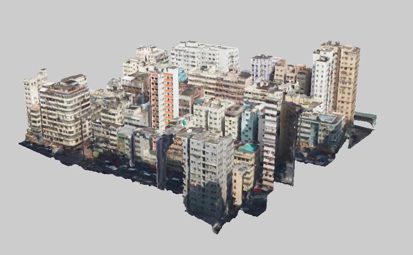
3D models of city blocks are now available for view or download for free
Meanwhile the 3D Visualisation Map shows topographical and exterior features of terrain, buildings and infrastructure that support visualisation and other geospatial applications. The dataset is created mainly by aerial imagery taken in 2017 and 2018 covering the whole territory. The dataset covering Tsuen Wan, Kwai Tsing, Tai Po and North District was released earlier this year. Together with the release of data for Yau Tsim Mong, Sham Shui Po, Kowloon City, Wong Tai Sin, Kwun Tong, Yuen Long and Tuen Mun, the dataset now covers more than 23,000 hectares of land in Hong Kong. The 3D Visualisation Map of the remaining districts will be released in phases up to the end of 2023.
The spatial datasets in machine-readable formats are now available for previewing and downloading on the Hong Kong GeoData Store (geodata.gov.hk) and the Public Sector Information Portal (data.gov.hk).