Wan Chai district has two streets in Street Reset’s top 10 crash density “hot zones”
Wan Chai Road is the most dangerous location in Hong Kong for pedestrian injuries, with 246 collisions per kilometre from 2015-2019, urban planning collective Street Reset has found.
In a unique geographical research report into five years of pedestrian deaths and serious injuries, the group ranked Hong Kong’s Top 10 “pedestrian collision hot zones” by crash density.
The grim list, compiled from over 16,243 collisions, includes two hot zones in Wan Chai, three in the New Territories (Tsuen Wan and Yuen Long) and five in Kowloon (Sham Shui Po, Wong Tai Sin, Kwun Tong and Yau Tsim Mong).
Wan Chai Road (the section between Heard Street and Burrows Street) is the top-ranked hot zone with the highest pedestrian collision density, while the Sham Shui Po market area (Pei Ho Street, Kweilin Street, Ki Lung Street, Tai Nan Street and Yu Chau Street), and the section between Johnston Road and Chun Yuen Street in Wan Chai ranked second and third.
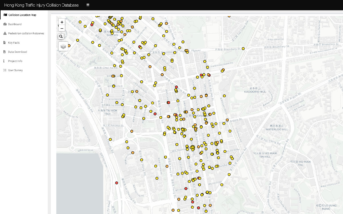
Street Reset has created an interactive map database of all pedestrian collisions over 2015-2019
“Most hot zones are located on local streets and four hot zones are located near markets (or municipal services buildings), which have high pedestrian flows and are key destinations in the neighbourhood,” says Street Reset founder Justin Yim.
The 56-page study also finds secondary roads have the highest risk of pedestrian collisions: 71% of collisions involving pedestrians happened on, or at junctions with, secondary roads.
“This may be in contrast to general perceptions that most collisions involving pedestrians happen on the main roads, which in fact only account for about 20% of pedestrian-related collisions,” he says.
Street Reset has published a unique interactive map showing hot zones and traffic collisions, available here, and calls for the government to create its own dashboard.
Recommendations from the group, which was founded by Yim in 2020, include adopting a “safe system approach” as an overarching principle in the government’s road safety strategy, prioritising pedestrians, lowering speed limits and managing vehicle speed, and including collision data transparency.
Street Reset also calls on the government to provide more at-grade crossing points “that fit better for prevailing pedestrian desire lines where possible”.

Pedestrian crossings in Mong Kok have been closed to make way for more motor vehicles
Data on road crashes is notoriously hard to find in Hong Kong: in May this year Transit Jam estimated it had only been able to identify half of the actual bicycle deaths from 2021, with many deaths unreported by police or Transport Department. Finding exact locations and details for even eight bicycle deaths involved trawling through thousands of pages of police reports to match dates and times of collisions given by Transport Department.
| Rank | Location | District | Pedestrian collisions (2015-2019) | Collision density (collisions/km) |
| 1 | Wan Chai Road | Wan Chai | 21 | 246 |
| 2 | Market Streets near Pei Ho Street Municipal Services Building (Pei Ho Street, Kwellin Street, Ki Lung Street, Tai Nan Street & Yu Chau Street) | Sham Shui Po | 126 | 166 |
| 3 | Johnston Road at the Junction of Spring Garden Lane | Wan Chai | 19 | 161 |
| 4 | Hong Keung Street & Tseuk Luk Street | Wong Tai Sin | 26 | 139 |
| 5 | Market Streets near Yeung Uk Road Market (Chuen Lung Street, Ho Pa Street, San Tusen Street) | Tsuen Wan | 99 | 133 |
| 6 | Market Streets near Shui Wo Street Municipal Services Building (Shui Ning Street, Shui Wo Street & Fu Yan Street) | Kwun Tong | 31 | 117 |
| 7 | Shanghai Street at theJunction of Jordan Road | Yau Tsim Mong | 29 | 109 |
| 8 | Tsuen Kwai Street at the Junction of Tsuen Fu Street | Tsuen Wan | 18 | 109 |
| 9 | Market Streets near Tung Yick Market (Tai Tong Road , Kuk Ting Street, Fau Tsoi Street, Hop Choi Street & Yat San Street) | Yuen Long | 50 | 107 |
| 10 | Area at the junction of Nathan Road and Dundas Street (Nathan Road, Dundas Street, Portland Street, Hamilton Street & Fa Yuen Street) | Yau Tsim Mong | 94 | 106 |
Table source: Street Reset